
TUSCALOOSA, Ala. – What happens underground on a farm can be just as consequential as what grows above it, and a new federal research program is using West Alabama’s working landscapes as a proving ground for much-needed agricultural solutions.
The CONSERVE Research Group, part of the Alabama Water Institute at The University of Alabama, and the USDA Agricultural Research Service, or ARS, Southeast are partnering to establish the Innovative Water Systems program. The program brings together three distinct research projects: modeling the ecological impacts of aquifer recharge, demonstrating native rivercane as an agricultural buffer crop and mapping the underground root architecture of rivercane using technology borrowed from archaeology.

“Having these national resources and assets interested in the type of work we do here at UA and CONSERVE, but also partnerships with landowners here in the area, is going to lift the whole region up,” said Dr. Michael Fedoroff, director of the CONSERVE Research Group.
USDA ARS Southeast is headquartered in Stoneville, Mississippi, with research capabilities across the region. CONSERVE’s partnership centers on collaboration with Dr. Christopher Delhom and the National Center for Alluvial Aquifer Research, which focuses on aquifer recharge, agricultural water use and contamination in the Lower Mississippi Valley and beyond.
The partnership draws on CONSERVE’s interdisciplinary makeup, bringing together mathematicians, ecologists and biologists, to apply state-of-the-art modeling and on-farm science to problems that have long resisted single-discipline solutions.
West Alabama and the Black Belt region anchor much of the work. Agriculture remains a defining part of the economy and landscape there, and the Innovative Water Systems program is designed to produce science that reaches working farms directly.
When the Aquifer Runs Low
The first project under Innovative Water Systems addresses one of agriculture’s quieter crises, groundwater depletion.
Aquifers beneath farming regions across the Southeast have been drawn down steadily by decades of irrigation. One solution is managed aquifer recharge, intentionally replenishing groundwater using surface water sources. The practice is already being supported in farm areas by the USDA, but the ecological consequences of large-scale recharge are not yet fully understood.
CONSERVE’s role is the modeling. Using the group’s capacity in mathematical and ecological science, researchers will work to characterize what happens to surrounding ecosystems when an aquifer is recharged, tracking impacts on soil, hydrology and the organisms that depend on both. The goal is to give decision makers and agricultural producers a clearer scientific picture before acting at scale.
Rivercane Returns to the Farm
The second project takes native rivercane out of the restoration context and places it directly into working agricultural systems.
![Two researchers wearing orange caps stand among tall native rivercane and mixed vegetation on a hillside in Tuscaloosa County, Alabama.]](https://awi.ua.edu/wp-content/uploads/sites/7/2026/06/02-Rivercane-Field-3996-cropped-web-ready-1024x655.jpg)
On-farm demonstrations across West Alabama will test rivercane as a rotational crop, measuring its capacity to pull excess phosphorus and nitrogen from water moving through the landscape, a process known as bioremediation. Researchers will also monitor its performance as an erosion control buffer along field edges and waterways, quantifying how much soil it holds and how it conditions the ground around it.
The science behind those claims is not new. Studies have shown that rivercane removes nutrients from water and builds soil fertility. What this program adds is on-the-ground documentation in active farming systems, along with a pathway to offer incentives to farmers.
“We’re demonstrating, through on-farm demonstrations, that rivercane can be used as erosion control and water quality improvement within farming systems, especially as a rotational crop,” Fedoroff said. “We’re going to monitor, track, quantify and promote.”
If USDA’s Natural Resources Conservation Service makes a future determination that rivercane qualifies as a conservation crop worthy of inclusion in production rotation, farmers could be eligible for federal incentive payments, giving an environmental practice a direct economic return.
Native Rivercane: A Plant Worth Knowing
Unlike invasive bamboo species that spread aggressively and resist removal, native rivercane grows slowly and behaves predictably. It does not take over fields. Its rhizome network builds rather than disrupts, holding soil in place and enriching it over time.
The confusion between native rivercane and invasive species is understandable. Decades ago, USDA encouraged farmers to clear cane brakes and plant cotton or corn for higher yields, a practice that gradually removed rivercane from the landscape and from common agricultural knowledge. As invasive Asian bamboos arrived and spread through farm fields, generations of farmers drew a logical but incorrect connection between the two plants.
The research underway through Innovative Water Systems is designed to put that distinction back where it belongs: in the field, supported by data, and in the hands of farmers who stand to benefit from it.
Reading the Underground
The third project is one Fedoroff has been working toward for two decades.
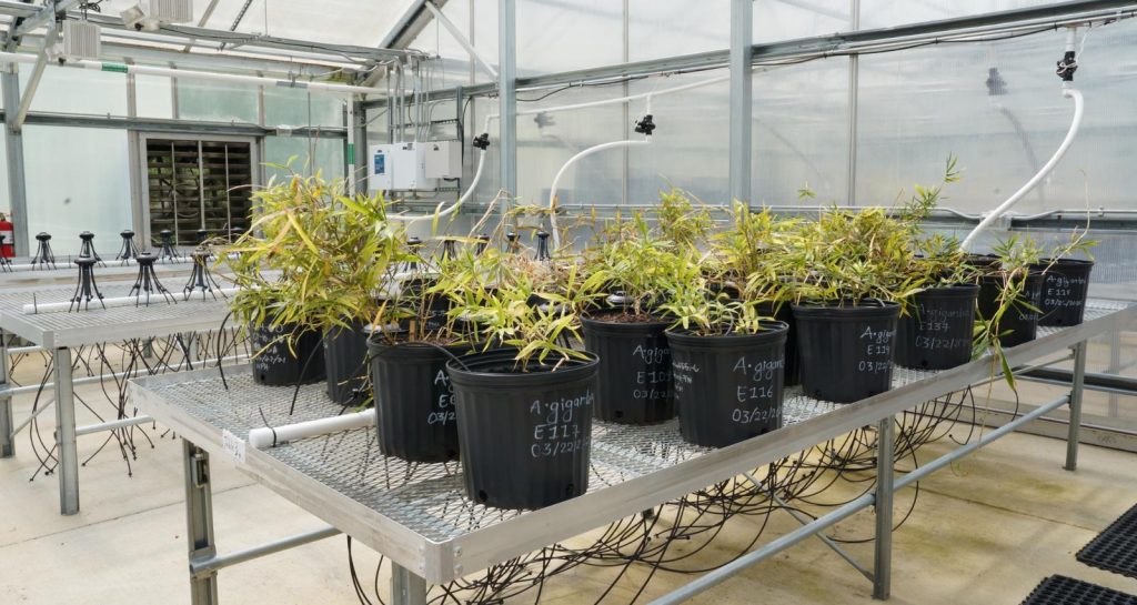
Rivercane’s most dramatic ecological performance happens underground. Where other plants might erode under floodwaters, rivercane stabilizes streambanks. Its root system, a dense network of rhizomes that spreads laterally beneath the soil, forms a mat that rises slightly with floodwater, allowing sediment to filter through while the bank beneath stays intact. Stream banks where rivercane grows not only remain intact, but also build new soil over time.
The question researchers have not been able to answer until now is: what, exactly, does that underground structure look like?
CONSERVE will use ground-penetrating radar, or GPR, a technology archaeologists and engineers use to image what lies beneath the surface, to create a three-dimensional map of the rivercane rhizomes. A survey line cut through a cane brake will allow researchers to run the GPR instrument across the ground, producing subsurface imagery that can be rendered in three-dimensional space.
The payoff connects directly to CONSERVE’s ongoing genetics work. Different genotypes of rivercane may produce different rhizome structures, and not all structures perform equally as erosion control. By mapping the underground architecture and linking it to genetic data, researchers can begin identifying which populations build the most effective natural barriers and which plants belong in which settings.
“We can figure out which genotype of that population makes the best rhizome network and what they look like,” Fedoroff said. “So now we can pick the right plant for the right engineering function.”
Once the structure is mapped and understood, it may be possible to replicate it through 3D printing, producing engineered erosion control structures modeled directly on nature’s own design.
The technology that made all of this possible, affordable genome sequencing, advanced 3D printing and GPR adapted from archaeological practice, came together through the kind of interdisciplinary collaboration that defines CONSERVE’s approach.
“We bring in a wide variety of transdisciplinary people,” Fedoroff said. “And because we do, these are the type of projects we can put together.”
Science That Reaches the Ground
The Innovative Water Systems program reflects CONSERVE’s applied identity. Research findings do not stop at publication. They move into the field, onto farms and into the hands of the communities they are designed to serve.
For West Alabama and the Black Belt, a region where agriculture is still very much a way of life, the attention of national research assets signals something larger than a single program. CONSERVE’s partnership with USDA ARS Southeast brings federal science infrastructure into direct contact with local land and the people who manage it.
“Agriculture is still very much an important way of life here. Having these national resources and assets interested in the type of work we do here at UA and CONSERVE, but also partnerships with landowners here in the area, is going to lift the whole region up.”
Dr. Michael Fedoroff
The Alabama Water Institute is one of The University of Alabama’s research institutes. AWI acts as a forum for interdisciplinary research and education by bringing together University researchers, students and staff to foster collaboration and a broad interdisciplinary focus on water issues that face our world today. AWI-affiliated researchers specialize in hydrologic and hydraulic modeling, water security and quality, remote sensing, biodiversity and watershed management and human health through synergies with AWI research programs, including the NOAA Cooperative Institute for Research to Operations in Hydrology, the Global Water Security Center and the CONSERVE Research Group.