Op-Ed by Dr. Travis Loof

Setting the Scene
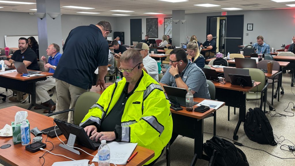
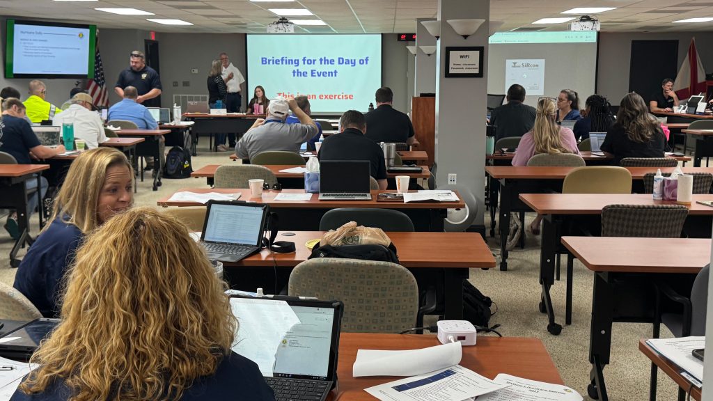
A few minutes before 8 a.m., the room was a quiet mix of coffee cups, maps and county binders. Then the briefing began. A Helene-like hurricane had tracked inland and pushed up the I-65 corridor. The scenario was blunt. Statewide power impacts. Road washouts. Compounding hazards. My stomach did a small flip, surprising me because I knew it was simulated. That feeling matters. It is the same nudge that reminds you why planning time is precious.
So began my daylong participation in the Alabama Emergency Management Agency’s Division F emergency response tabletop simulation exercise. Tabletop exercises are a practical way for emergency managers and stakeholders to practice, simulate and identify areas that need improvement before catastrophic events occur. At this exercise, I took part as a participant observer for Division F. Division F is one of seven AEMA divisions, labeled A through G. It includes Blount, Cherokee, Cullman, DeKalb, Etowah, Jackson, Limestone, Madison, Marshall and Morgan counties. To reflect real regional coordination, other partners also participated, such as the Alabama Department of Public Health, the Alabama Department of Transportation, Tennessee Emergency Management, NASA decision support and the National Weather Service.

What Actually Happened in the Room
Before we gathered in person, participants received a simulated forecast style briefing a few days ahead, mirroring the real lead up to a landfall threat. Once we settled in, the NWS team walked us through an updated forecast and current conditions on the ground. The situation had shifted from bad to worse.
Our exercise lead, Division F coordinator Kirk Webb, then introduced a set of injects that translated weather conditions into operational consequences. These injects grounded the discussion in realism. After each set of injects, counties and partners assessed assets and capabilities, then developed response options. This was unexpectedly immersive. Participants called back to their home offices or used internal messaging to coordinate with their real counterparts. After a few minutes, each group reported response options, including where mutual aid might be needed. The dialogue stayed practical: which roads might fail first, which neighborhoods are hardest to reach, which health services must stay running and how to coordinate and triage response.
Subsequent rounds followed the same rhythm: updated weather briefings, condition assessments and localized injects. A dam failure for one county. A tornado impact for another. A flooded business corridor that altered traffic and supply routes. NWS provided simulated flood inundation maps and the NWIPS system so teams could practice with real tools. Participants discussed where to pre stage search and rescue and how to reroute care and supplies. These rounds continued into the afternoon. We ran out of our scheduled time just as we reached the recovery phase. Credit to EMA coordinator Webb for maintaining a design that mirrors how disasters unfold. Messy. Local. Time sensitive.

Why Tabletop Exercises Matter
Here are my three takeaways from seeing the format up close:
- They highlight gaps in plans and communication while the stakes are low. Better to find a blind spot with sticky notes and laptops than during a siren-filled night. For example, there was an honest and frank discussion about how to request state assets based on the problem at hand rather than on what a county might think is the only solution they know about.
- They build shared mental models across agencies. When everyone sees the same map and hears the same thresholds, coordination speeds up. For example, there was a discussion about how to format requests and certain communications that would speed up coordination, especially in a catastrophic situation.
- They normalize the use of real tools under time pressure. Practice creates muscle memory for the decisions that protect lives.
Where CIROH and AWI Fit
I attended with two goals. First, evaluate how the NOAA Office of Water Prediction and Cooperative Institute for Research to Operations in Hydrology, or CIROH, research products fit the needs of emergency managers. Where do our flood products help? Where do they slow a decision? Which improvements could unlock faster action? Second, understand how tabletop formats turn research findings into planning steps that counties can carry into the next storm season.
This exercise offered direct answers. Flood inundation maps supported a common picture, especially when county teams layered local knowledge about bridges, culverts and vulnerable neighborhoods. I also saw opportunities to make products even more useful. For example, developing clearer symbology for rapid triage and creating quick toggles for critical infrastructure layers, or even using small confidence cues that tell a busy operations chief where and when to prioritize action.

Why This Matters Beyond One Room
CIROH and the Alabama Water Institute exist to shorten the distance between new knowledge and everyday practice. Watching responders use our products in a realistic setting is the quickest way to make them better. We can adjust a legend, add an overlay or streamline a workflow. Emergency managers can add a job aid, refine a threshold or rehearse a plan. Everyone leaves better prepared.
What We Are Taking Forward
- Co-design sessions with county and state partners to refine map layers and labels for fast decision making.
- Usability testing that matches operations tempo so we learn what works when time is tight.
- Training materials and quick start guides that fit inside existing planning binders.
- Continued collaboration with AEMA, NWS, public health, transportation and neighboring state partners so research answers the questions they face on their hardest days.
On a personal note, I left the experience with a sense of excitement, fear and most importantly cautious optimism. Even in a simulation, the volume of information is huge, and choices arrive quickly. That pressure is exactly why this work matters. I left grateful for the professionals in the room and motivated to carry their feedback back to CIROH and AWI so our products can carry more weight in the next exercise and the next storm.

Dr. Travis Loof is a research-to-operations scholar bridging media psychology, human-AI interaction, and crisis communication. His work focuses on translating social and communication science insights into operational tools, particularly AI-driven crisis solutions for government agencies like NOAA, ensuring research directly informs real-world decision-making. Travis’s expertise spans human-AI teamwork dynamics, public trust in emerging technologies, and interdisciplinary collaboration across hydrology, cyber-social systems, and communication science. He empowers communities by connecting researchers, policymakers, and operators to design actionable strategies while mentoring students to become skilled knowledge producers. Travis is affiliated with the Alabama Water Institute (UA), Center for Cyber-Social Dynamics (KU), and the Cooperative Institute for Research to Operations in Hydrology (UA).